the rivers, rich in history and folklore, are peaceful and picturesque. this guide gives a brief history of the development of the river system and an account of the principal attractions within the corridor of the rivers. it will be of interest to all river users, particularly navigators and...
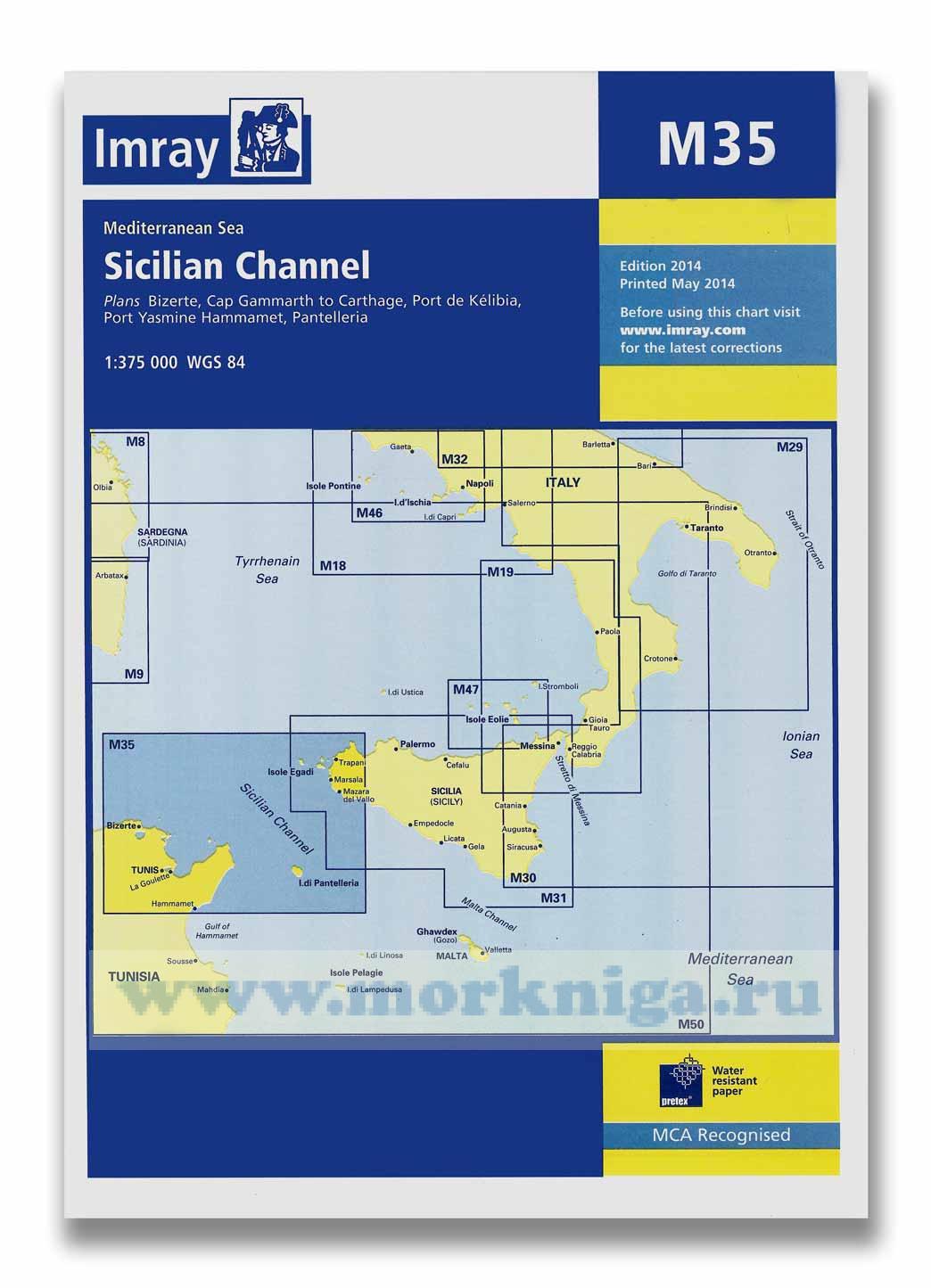
a brand new chart of the sicilian channel, designed to show passage from west sicily to isola di pantelleria and the tunisian coast. plans included: [url4107]bizerte[/url4107] (1:30 000) cap gammarth to carthage (1:65 000) port de k?libia (1:15 000) port yasmine hammamet (1:25 000) ...
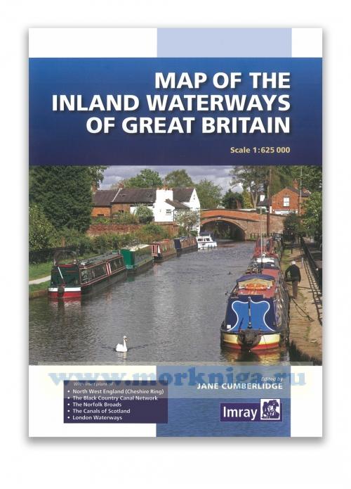
first published over 60 years ago when interest in reviving britain's network of navigable and rivers was starting to gather pace, this map provides the best coverage of the system in england, wales and scotland. distances, the number of locks and restricting dimensions are given for each...
См. также [url00-00001643] the cruising almanac with tide tables[/url00-00001643] 2019 available separately from the cruising almanac 2019. contents aberdeen belfast brest brest - tidal coefficients 2019 bristol (avonmouth) calais cherbourg cobh cuxhaven dieppe dover ...
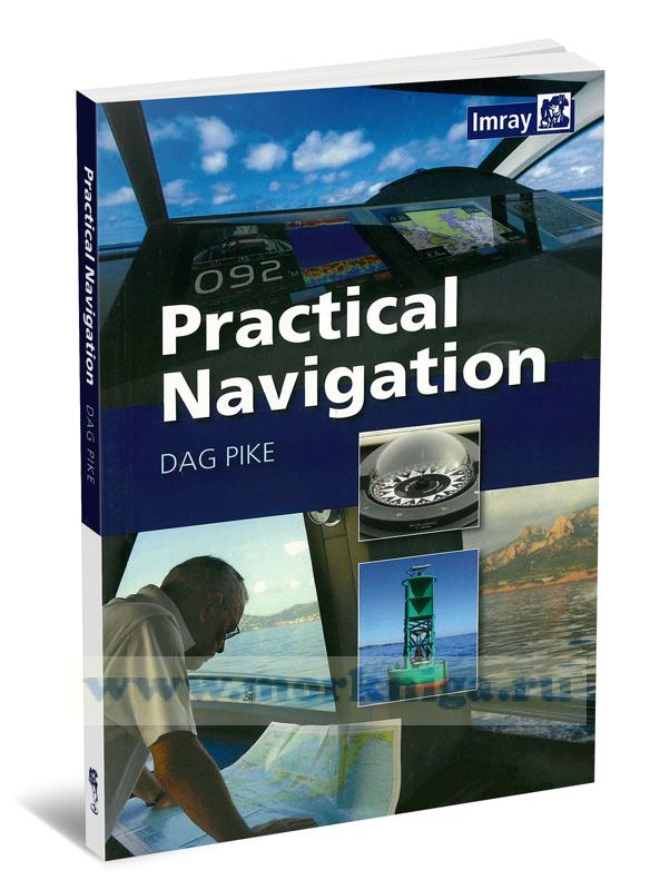
this comprehensive and authoritative guide to practical navigation draws on the author's extensive experience of leisure cruising and ocean racing. it combines detailed directions on how to navigate along coasts, in harbours, at night and in bad weather with easy-to-understand technical...
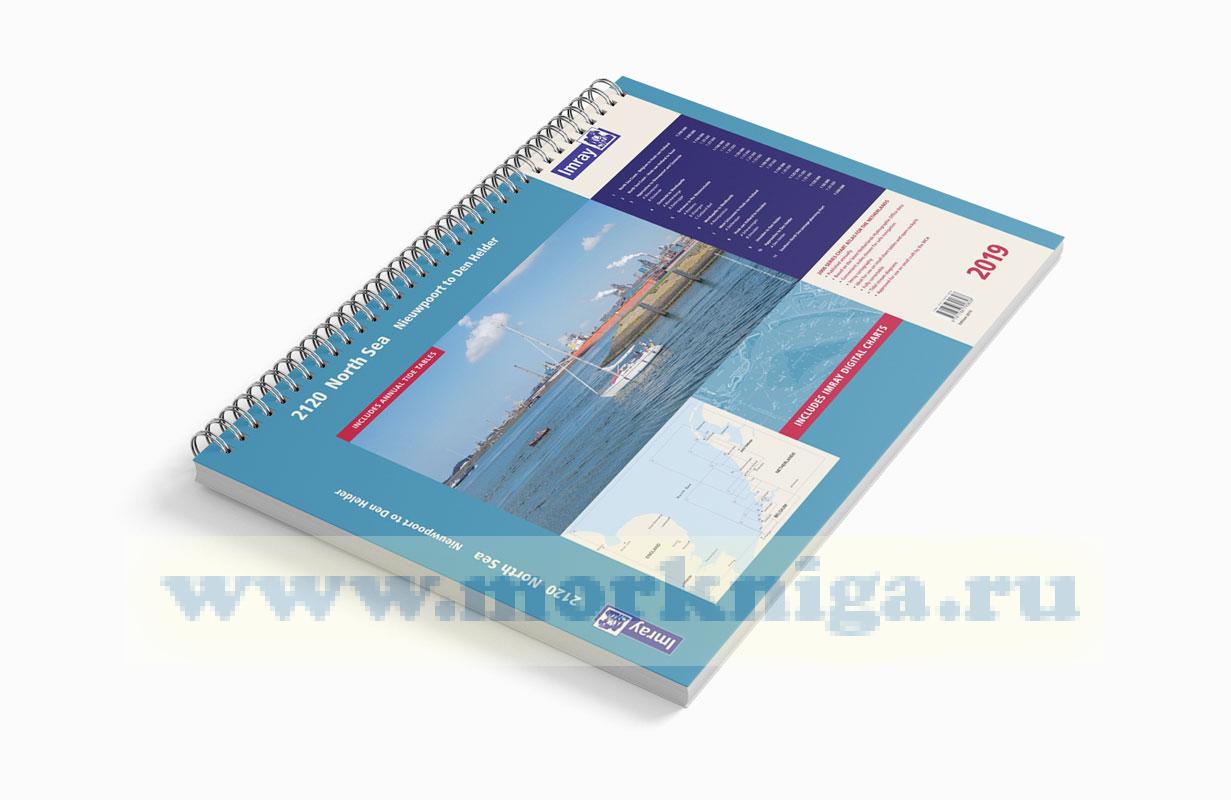
part number: yot0862 scale: 1:1(various) isbn: 9781786790828 manufacturer: imray laurie norie and wilson ltd publisher: imray laurie norie and wilson ltd author: imray edition: 2019
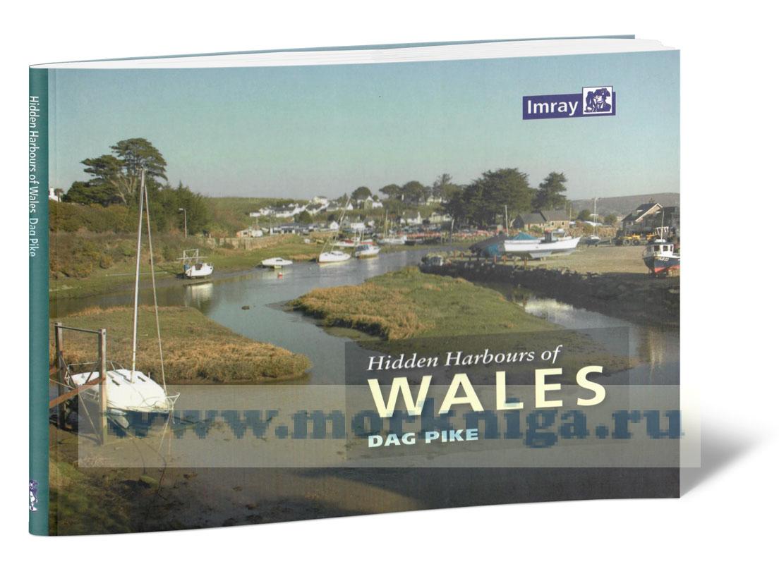
Издание на английском языке hidden harbours of wales is a tour of small and infrequently visited harbours on the welsh coast, starting from lydney on the river severn and finishing a world away at connah's quay on the river dee on the north coast. 'hidden harbours'...
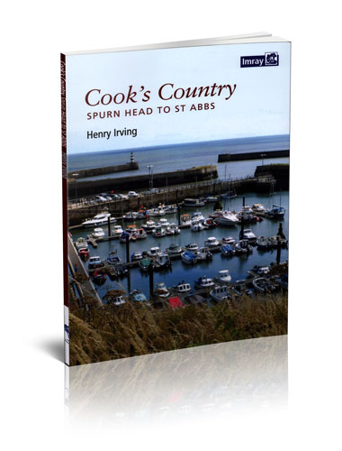
Издание на английском языке cook’s country is a wholly original guide to the uniquely scenic and historic coasts of north yorkshire and[url455406] northumberland[/url455406]. the author’s fascinating personal insights complement information on all aspects of this...
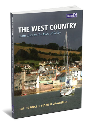
Издание на английском языке the west country is a brand new cruising guide covering lyme bay to land’s end and the isles of scilly. it provides essential sailing directions and detailed listings of facilities together with a wealth of information for those wishing to...
Издание на английском языке . the essential marine data resource for yachts sailing the mediterranean, the imray mediterranean almanac is published biennially with updates available in a downloadable supplement at the end of the first year. the harbour information section,...
Издание на английском языке this book is a comprehensive guide to maritime voyages and navigation along the northern coast of great britain, particularly in the orkney and shetland islands. it contains extensive information on safe navigation rules and regulations,...
Издание на английском языке the book is devoted to practical maritime navigation and is a set of navigation tables with detailed explanations on their application. the publication contains calculation tables and formulas used in coastal and ocean navigation, including...
greek waters pilot is the definitive cruising guide to the coasts and islands of greece. it covers the entire area from the [url806048]ionian islands[/url806048] to the aegean, [url150296]rhodes[/url150296] and [url154271]crete[/url154271] and includes details of over 450 harbours in a single...
Издание на английском языке the plans in this guide are not to be used for [url209]navigation[/url209] - they are designed to support the text and should always be used together with navigational charts. even so, every effort has been made to locate harbour and...
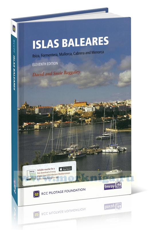
this eleventh edition of islas baleares, covering ibiza, formentera, mallorca, cabrera and menorca, has been revised and updated for the rcc pilotage foundation by david and susie baggaley, whose beneteau 42, kookaburra has been based in addaya, menorca for several years. in their research for...
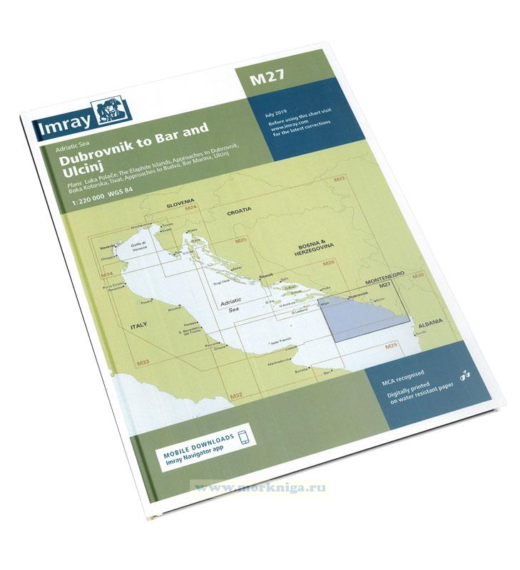
imray charts set the standard for the leisure sailor, with award-winning cartography compiled, drawn and published in england. our distinctive colour scheme, coloured light sectors and fine overprinted latitude and longitude grids make plotting easier. based on up-to-date hydrographic office...
Издание на английском языке every effort has been made to ensure the accuracy of this book. it contains selected information and thus is not definitive and does not include all known information on the subject in hand; this is particularly relevant to the plans, which...
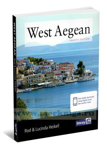
rod heikell's [url196935]west aegean[/url196935] covers the coasts and islands near athens, the adjacent islands in the [url806053]cyclades[/url806053] and the [url456065]eastern peloponnisos[/url456065] to monemvasia. also covered is the mainland coast of greece from sounion to...
imray charts set the standard for the leisure sailor, with award-winning cartography compiled, drawn and published in england. our distinctive colour scheme, coloured light sectors and fine overprinted latitude and longitude grids make plotting easier. based on up-to-date hydrographic office...
Нажмите “ОК”, если вы соглашаетесь с условиями обработки cookie и ваших
данных о поведении на сайте, необходимых для аналитики. Запретить обработку cookie можете через браузер