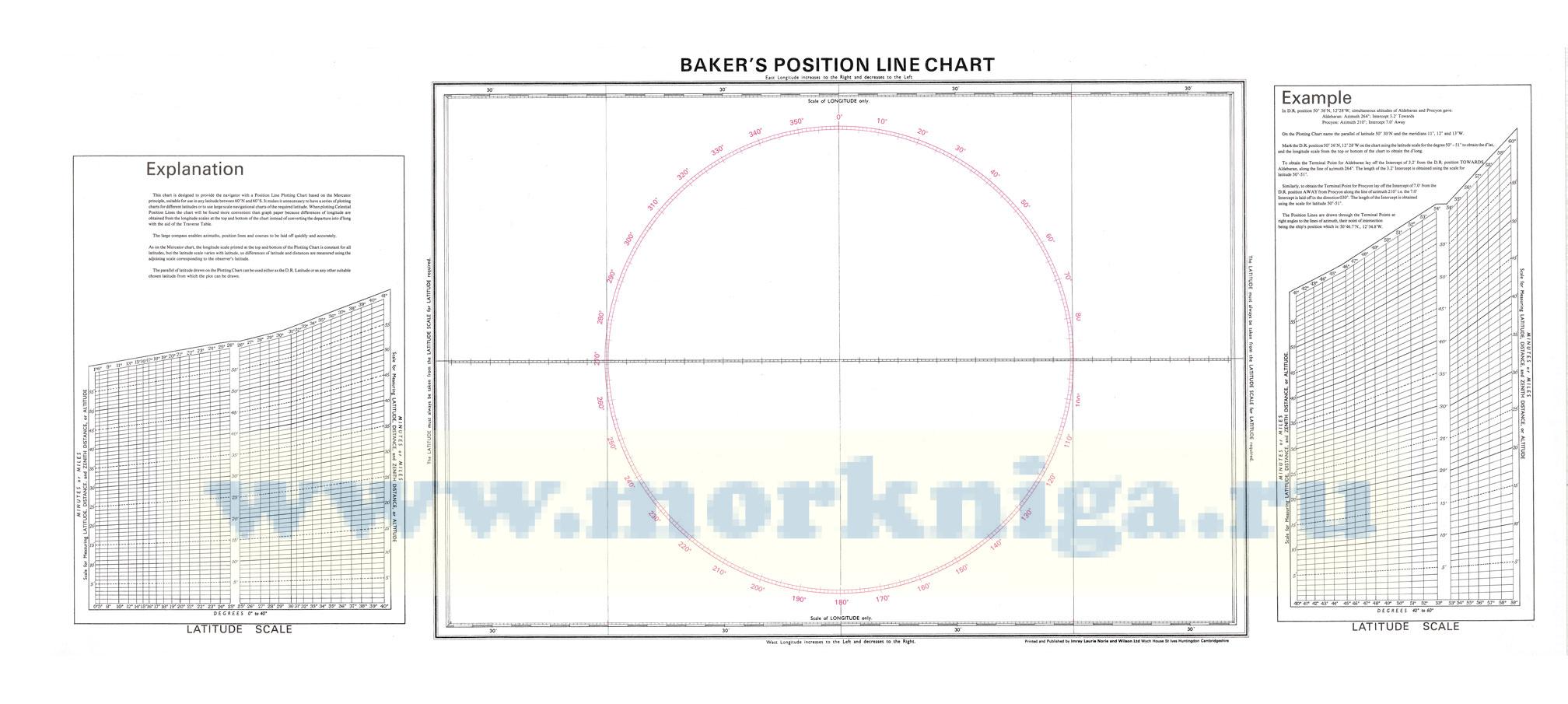
this chart is designed to provide the navigator with a position line plotting chart based on the mercator principle, suitable for use in any latitude between 60°n and 60° s. it makes it unnecessary to have a series of plotting charts for different latitudes or to use large scale navigational...
Нажмите “ОК”, если вы соглашаетесь с условиями обработки cookie и ваших
данных о поведении на сайте, необходимых для аналитики. Запретить обработку cookie можете через браузер