

Каталог▲▼
Reeds Nautical Almanac 2021
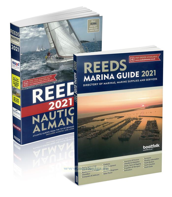


Артикул: 00-01052322
в желания В наличии
Издательство: Adlard Coles Nautical (все книги издательства)
Место издания: London
ISBN: 9781472980212
Год: 2021
Переплет: Мягкий переплет
Страниц: 1198
Вес: 2100 г
Похожие товары
Издание на английском языке
This Almanac provides basic navigational data for planning and executing passages. The tidal prediction data has been reproduced by permission of national hydrographic offices. Chartlets illustrate items in the text, orientate the user and highlight key features; they should not be relied on for navigational purposes and must always be used in conjunction with a current, corrected navigational chart. Any waypoint or position listed in this Almanac must first be plotted on the appropriate chart to assess its accuracy, safety in the prevailing circumstances and relevance to the Skipper's intentions.
Navigational guidance or suggestions are based on the accumulated experience of editors, agents, harbour masters and users. They are generic and in compiling a passage plan or pilotage notebook all other available publications and information should be consulted. They take no account of the characteristics of individual vessels nor the actual or forecast meteorological conditions, sea or tidal state. These need to be checked with appropriate local authorities for the intended area of operation prior to departure.
Сontents
Section 1
Chapter contents
Navigational contents
Introduction
Editorial
Using the almanac
Improvements
Agents wanted
Corrections Acknowledgements and Permissions
Chapter 1. Reference data
Symbols and Abbreviations
Useful addresses (postal and e-mail) and websites 2021 Calendar
Eclipse notes
Conversion tables
Time
Vocabularies
Chapter 2. Regulations
Cruising formalities
HM Revenue and Customs
Foreign Customs International Regulations for Preventing Collisions at Sea (COLREGs)
VAT
Chapter 3. Navigation
Passage planning/SOLAS V
Conduct of the plan
Light characteristics
IALA buoyage Satellite navigation
Hydrographic surveys
Electronic charts
Waypoints
Chart plotters
Radar and AIS
Racons and ramarks
Navigational warnings
Hazards
Offshore energy installations
Navigational tables: Distance of horizon
Distance, speed and time
Distance off by sextant
True bearing of sun at sunrise/set
Sun's declination
True bearing of sun
Distance off rising/dipping lights
Sunrise/set times
Moon rise/set times
Phases of the Moon
Chapter 4 Tides
Introduction
Definitions
Calculating times/heights of tide
Overhead clearances Computer predictions
Tidal streams
Meteorological effects
Tidal stream rates
Chapter 5. Communications
International code of signals
Radio communication
Global communications
Navigational warnings
Gunfacts and subfacts
Coastal radio stations (CRS)
Coastguard contact details for UK
Coast Guard contact details for Republic of Ireland, Denmark, Germany, The Netherlands, Belgium, France, Spain, Portugal, Gibraltar
Chapter 6. Weather
Beaufort wind scale
Sea states
Heavy weather warnings
GMDSS weather NAVTEX
HM Coastguard broadcasts
HF facsimile
BBC broadcasts
Internet weather resources
Sources of foreign weather information
Chapter 7. Safety
Introduction
Safety equipment
GMDSS
Definitions of emergencies
Emergency signals
MAYDAY
PAN PAN
SECURITE
Sound & visual distress signals Helicopter rescue
Abandon ship
UK SAR
HM CG
SSG
RNLI
NCI
Chapter 8. First aid
Objectives
Medical care abroad
Medical advice by R/T
Emergency resuscitation 1 Choking
Drowning
Hypothermia
Shock
Acute illness
Stroke
Bites/stings Bleeding
Burns
Chest and crush injuries
Cuts
Dental
Eyes
Fish hooks
Fractures
Poison
Sprains
First aid kits
Drugs
Emergency childbirth
Injections
Physiological measurements
Observation form
Chapter 9. Harbours, coasts and tides
Map of areas
Area information
Harbour information
Environmental guidance Distance tables: English Channel, Irish Sea, North Sea, Bay of Biscay See page ix for details
General index
Gazetteer (index of place names)
Chapter 9. Harbours, coasts and tides
Map of areas
Harbour details and tide tables
Tidal streams
Lights, buoys and waypoints
Passage information
Ferries
Distance tables
Special notes
Area 1. South West England, including Isles of Scilly
Isles of Scilly to Anvil Point
Area 2. Central Southern England
Anvil Point to Selsey Bill
Area 3. South East England
Selsey Bill to North Foreland
Area 4. East England
North Foreland to Great Yarmouth
Area 5. North East England
Winterton to Berwick-upon-Tweed
Area 6. South East Scotland
Eyemouth to Rattray Head
Area 7. North East Scotland
Rattray Head to Cape Wrath, incl Orkney and Shetland Islands
Area 8. North West Scotland
Cape Wrath to Crinan Canal
Area 9. South West Scotland
Crinan Canal to Mull of Galloway
Area 10. North West England, Isle of Man and North Wales
Mull of Galloway to Bardsey Island
Area 11. South Wales and Bristol Channel
Bardsey Island to Land's End
Area 12. South Ireland
Malahide clockwise to Liscannor Bay
Area 13. North Ireland
Liscannor Bay clockwise to Lambay Island
Area 14. West Denmark
Skagen to Romo
Area 15. Germany
Danish border to Emden
Area 16. The Netherlands and Belgium
Delfzijl to Nieuwpoort
Area 17. North France
Dunkerque to Cap de la Hague
Area 18. Central North France
Cap de la Hague to St Quay-Portrieux
Area 19. Channel Islands
Alderney to Jersey
Area 20. North Brittany
Paimpol to Pointe de Penmarc'h
Area 21 South Brittany
Loctudy to St Nazaire
Area 22. South Biscay
River Loire to Spanish border
Area 23. North and North West Spain
Fuenterrabia to Bayona
Area 24. Portugal
Viana do Castelo to Vila Real de Santo Antonio
Area 25. South West Spain, Gibraltar and Morocco
Ayamonte to Europa Point, Tangier and Ceuta Area
Portuguese Islands
Azores: Flores, Faial, Pico, Sao Jorge, Graciosa, Terceira, Santa Maria and Sao Miguel. Madeira: Porto Santo and Madeira
Section 2
Area 1. South West England
Area 2. Central Southern England
Area 3. South East England
Area 4. East England
Area 5. North East England
Area 6. South East Scotland
Area 7. North East Scotland
Area 8. North West Scotland
Area 9. South West Scotland
Area 10. North West England
Area 11. South Wales & Bristol Channel
Area 12. South Ireland
Area 13. North Ireland
Area 14. Channel Islands