

Каталог▲▼
Admiralty Sailing Directions. NP21. Bay of Bengal Pilot.

Артикул: 00-01124518
в желания В наличии
Издательство: Admiralty (все книги издательства)
Место издания: UK
Год: 2025
Формат: А4 (210х297 мм)
Переплет: Мягкая обложка
Страниц: 265
Вес: 663 г
Издание на английском языке
The book is a sailing guide and navigational reference for the Indian Ocean and Bay of Bengal regions, containing information on countries, dangers, currents, weather, navigation regulations and a detailed description of coastal regions and islands for safe navigation.
Content
Record of updates
Preface
Reporting new dangers to navigation
Feedback
Contents
Abbreviations
Glossary
Chapter Index Diagrams
Chapter 1. Countries, Navigation and Regulations
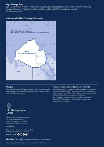
Limits of the book (1.1)
Country information (1.2)
Navigational dangers and hazards (1.16)
Traffic and operations (1.28)
Charts (1.33)
Aids to navigation (1.40)
Pilotage (1.47)
Radio facilities (1.48)
Regulations (1.57)
Signals (1.68)
Distress and rescue (1.73)
Natural conditions
Maritime topography (1.80)
Currents, tidal streams and flow (1.82)
Sea level and tides (1.92)
Sea and swell (1.93)
Sea water characteristics (1.96)
Climate and weather (1.99)
Climate information (1.131)
Chapter 2. India, Point Calimere to Vamsadhara River, including The Coromandel Coast
Chapter 3. India, Vamsadhara River to Hugli River including Kolkata
Chapter 4. Hugli River to Elephant Point, including Chattogram and the Chattogram Coast
Chapter 5. Elephant Point to Mawdin Point
Chapter 6. Bay of Bengal - eastern part, Mawdin Point to Dawei Point
Chapter 7. Bay of Bengal - south-eastern part, Dawei Point to Chong Pak Phra
Chapter 8. Andaman Islands, Preparis Island and Coco Islands
Chapter 9. Nicobar Islands
Index
Index
Отзывы покупателей (0)
У этого товара пока нет отзывов. Поделитесь впечатлением первым.