

Каталог▲▼
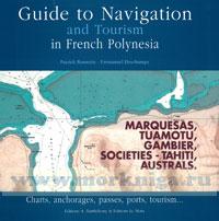
Guide To Navigation and Tourism in French Polynesia
Артикул: 00455438
в желания Нет в наличии
Автор: Bonnette/Deschamps
Издательство: TBC (все книги издательства)
ISBN: 978-2-87923-152-3
Переплет: Интегральный переплет
Страниц: 286
Сообщить о поступлении.
С этим товаром покупают
 Hawaiian Islands
  US Pacific Coast
  Western Coast of Mexico, including Baja
The islands of Polynesia are emerged underwater volcanoes of the Hawaiian type, which erupted from a north-south dorsal that extends to the north-west according to the drifting movement of the oceanic floor, called plate tectonics. The volcanoes correspond to the "hot spots" of the floor, from which the deep magma spouted. Taking into account the incessant drift of this floor, the islands born at these hot spots drift progressively westward (10 cm per year), while the hot spots continue to spew forth magma, creating a new volcano, etc. As these islands drift westward, they sink into the oceanic floor under their own weight (which is called subsidence), and the coral that had colonized their shores remains on the reef base that it has created. Thus, the island is diminished in size and height and the space left between the original reef and the new shores is then filled in by a lagoon, which enlarges as the island shrinks. During the final stage the island totally disappears under the water's surface, and there remains only a central lagoon and the reef crown, which is then an atoll. We can then say that the high islands, without lagoon nor crown reef (the Marquesas) are the youngest, and those that have a vast lagoon are the oldest (the Society Islands), and in between are the atolls. The maritime space occupied by French Polynesia extends over 5,500,000 square kilometers (counting the territorial waters), and if we superimpose a map of the territory over a map of Europe, we can see that the five archipelagoes are dispersed over a distance equaling that from Brest to Bucarest and from Stockholm to Rabat. The combined land surface of these 118 islands is only 4,000 square kilometers, a mere speck of dust scattered on the immense ocean.
Содержание:
Contents
Foreword
Acknowledgements
Introduction
I. Galicia
A Coruna to the Portuguese border
1. Rias Altas
A Coruna area
A Corufia to Laxe
Laxe to Finisterre
Cabo Finisterre and Seno de Corcubion
2. Finisterre to Isla Ons
Ria de Muros
Ria de Arousa
3. Ria de Arousa to Baiona and La Guardia
Ria de Pontevedra
Ria de Vigo
Baiona to la Guardia
II. Portugal - the West Coast
Foz do Minho to Cabo de Sao Vicente
1. Foz do Minho to Leix5es
2. Porto to Figueira da Foz
3. Figueira da Foz to Cabo da Roca
4. Approaches to the Rio Tejo and Lisbon
5. Cabo Espichel to Cabo de Sao Vicente
III. The Algarve and Andalucia
Cabo de Sao Vicente to Gibraltar
1. Cabo de Sao Vicente to Tavira
2. The Rio Guadiana to the Rio Guadalquivir
3. The Rio Guadalquivir to Cabo Trafalgar
4. Cabo Trafalgar to Gibraltar
Appendix
I Charts
II. Waypoints
III. Facilities
IV. Useful addresses
V Regulations, tax and VAT in Spain
VI. Marina charges in Galicia
VII. Portugal and Andalucia on the Net
VIII. Glossary
Index
Отзывы покупателей (0)
У этого товара пока нет отзывов. Поделитесь впечатлением первым.