звоните нам Пн-Пт с 9 до 19,
Сб с 10 до 16
Сб с 10 до 16
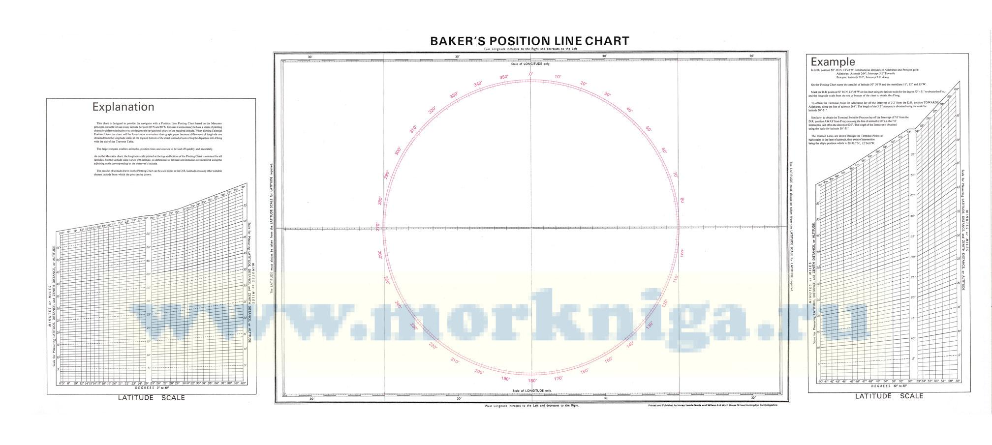
This chart is designed to provide the navigator with a Position Line Plotting Chart based on the Mercator principle, suitable for use in any latitude between 60°N and 60° S. It makes it unnecessary to have a series of plotting charts for different latitudes or to use large scale navigational charts of the required latitude. When plotting Celestial Position Lines the chart will be found more convenient than graph paper because differences of longitude are obtained from the longitude scales at the top and bottom of the chart instead of converting the departure into d'long with the aid of the Traverse Table.
The large compass enables azimuths, position lines and courses to be laid off quickly and accurately.
As on the Mercator chart, the longitude scale printed at the top and bottom of the Plotting Chart is constant for all latitudes, but the latitude scale varies with latitude, so differences of latitude and distances are measured using the adjoining scale corresponding to the observer's latitude.
The parallel of latitude drawn on the Plotting Chart can be used either as the D.R. Latitude or as any other suitable chosen latitude from which the plot can be drawn.
Размер:
Длина: 110 см
Высота: 45 см
 RAYS celestial almanac 2014-2021. Yacht Edition
  Astro Navigation Handbook
  Norie's Nautical Tables