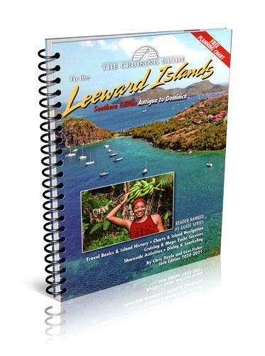
Cruising Guide to the Southern Leeward Islands 2020/2021
This 16th edition (2020-2021) is split into two guides, The Cruising Guide to the Northern Leeward Islands and The Cruising Guide to the Southern Leeward Islands. The Cruising Guide to the Southern Leeward Islands picks up where The Cruising Guide to the Northern Leeward Islands ends, and covers the islands of Antigua, Barbuda, Guadeloupe, Marie Galante, the Saintes, and Dominica. If you are sailing south, there is a section covering passages into the Windward Islands (Martinique, St. Lucia, St. Vincent and Grenada), which are covered in The Sailors Guide to the Windward Islands.
These guides are an essential tool for all cruisers sailing this region. The authors spend months sailing these islands to update each edition. Included are over one hundred up-to-date color sketch charts, full color aerial photos of most anchorages, island pictures, and detailed shoreside information covering services, restaurants, provisioning, travel basics and island history.
Information is linked to the author’s website where you can download the GPS waypoints given in the sketch charts, learn of essential updates, print town maps, and obtain links to local weather, news, and businesses.
A free 17 x 27 inch waterproof planning chart of the northern and southern Leeward Islands is now included in each edition!
Table of contents
Planning Your Cruise
Introduction
Currency
Tourist Season
What to Bring
Language
Local Customs
Water Skiing
Green Flash
Hazards
Sea Safety
Drugs
Suntan
Photography
Fishing
Sargasso Weed
Volunteering
Caribbean Regattas
Reading
Magazines and Newspapers
Snorkeling and Diving
Birds
History
Chartering
Charter Companies in Antigua
Charter Companies in Guadeloupe
USA and Overseas Charter Agents
Cruising Information
Navigation
. Buoyage System
Weather
Customs And Immigration
Communications
Security Aboard
Garbage
Radio
Environmental Notes
Leeward View of the Constellations
Distance Table for the Leewards
GPS Satellite Navigation in the Leeward Islands
Professional Yachts
Antigua
Guadeloupe
Dominica
Scuba Diving
Anchorages from Barbuda to Dominica
Antigua and Barbuda
Barbuda
Codrington
Cocoa Point
South Coast Of Barbuda
White Bay
Gravenor Old Dock Anchorage
Anchorage East of Cocoa Point
West Coast North of Cocoa Point
Coral Group Bay Boat Harbour
Palmetto Point to Low Bay
North Barbuda.
Antigua
English And Falmouth Harbours
English Harbour
Falmouth Harbour
Indian Creek
Mamora Bay
Willoughby Bay
Nonsuch Bay And Green Island
Green Island
Tenpound Bay
Rickett Harbour
North And West Green Island
Nonsuch Bay
Cork Point to Nanny Island.
Browns Bay
Hughes Bay to Ayres Creek
Ayres Creek to Clover Leaf Bay
Clover Leaf Bay
Inside the Reef: Flat Point to Diane Point
Heading North: The Spithead Channel
Antigua’s Northeast Coast
Northern Antigua
Boon Channel to Guiana Island
Shell Beach Boatyard and the Airport
Long Island Anchorage
Maiden Island Anchorage
Crabbs Haul Out
Parham
Great Bird And Other Outer Islands
The West Coast of Antigua
Dickenson Bay
St. John’s
Deep Bay
Deep Bay to Barrel of Beef
Five Islands Harbour
Jolly Harbour
Morris Bay
Ffreys Point to Pelican Island
Southern Antigua
Pelican Island to Falmouth
Passages Between Antigua and Guadeloupe
Guadeloupe
North to South:
Guadeloupe’s Western Coast
Deshaies
Pigeon Island Anchorage
Anse a la Barque
Basse-Terre
Trois Rivieres
North to South:
Guadeloupe via Riviere Salee
Port Louis
Grand Cul-de-sac Marin
Ilet a Colas Anchorage
Baie-Mahault
Pointe Grande Riviere Anchorage
Het a Fajou Anchorage
Riviere Salee

 Grenada to the Virgin Islands От Гренады до Виргинских островов, включая Гренадины, Сент-Винсент, Барбадос, Санта-Лючию, Мартинику